OSiRIS Research Highlight Physical Oceanography Simulations
![]()
![]()
B. Arbic, University of Michigan
J. Shriver, U.S. Naval Research Laboratory
Our research is on physical oceanography, the physics of the ocean. We use large supercomputers to simulate oceanic motions. The US Navy uses our simulations to forecast the behavior of ocean currents and tides, just as atmospheric scientists use models of the atmosphere to forecast the weather. We are on two NASA satellite mission science teams, because our simulations are used to predict the measurements of satellites used to monitor the ocean. In turn, observations from the NASA satellites are used to constrain our models, in a process known as “data assimilation”, which is also used in weather forecasting.
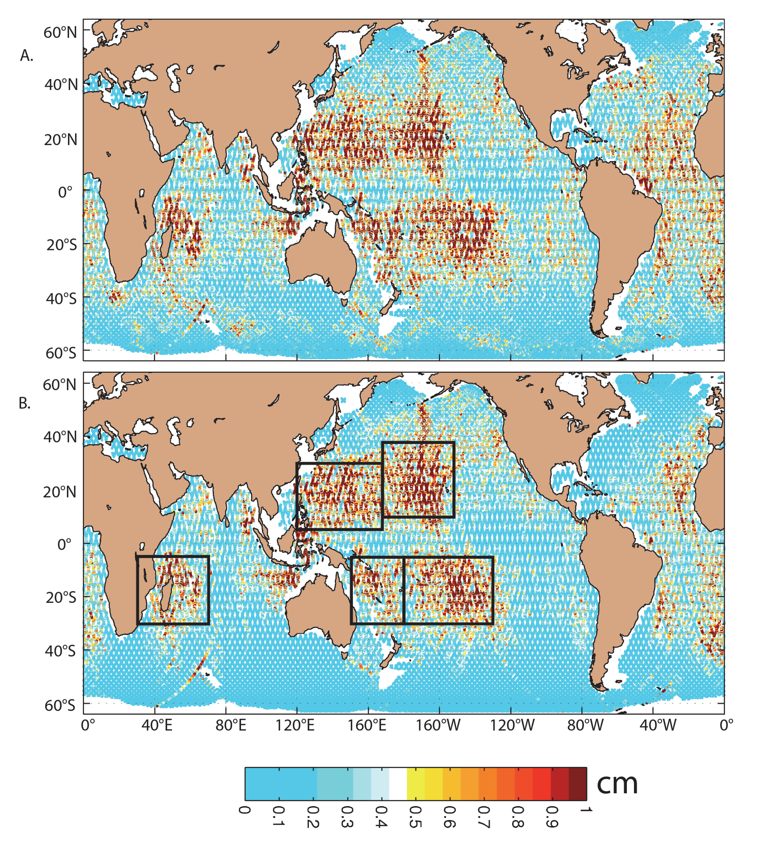 Figure 13.19 from A Primer on Global Internal Tide and Internal Gravity Wave Continuum Modeling in HYCOM and MITgcm
The figure at right shows the sea surface height signature of internal tides, which are tides that have their greatest signals at depth, but still have a signal at the sea surface that is measurable by satellite altimeters. The figure, taken from Jay Shriver’s 2012 paper, compares the internal tide amplitudes in the Navy model vs. satellite altimetry. The five subregions denoted by black boxes in (B) are used to compute the area-averaged amplitudes in Table 2 of the paper.
OSiRIS is a very useful tool for us, because it allows us to share the outputs of model simulations run on Navy and NASA machines, with scientists who do not have accounts on those machines. OSiRIS therefore allows for a wider dissemination of model information.